

The nation's largest 10-mile race is just days away as 40,000 runners prepare to hit the pavement for the 47th annual Independence Blue Cross Broad Street Run on Sunday.
Here's what you need to know ahead of the race:
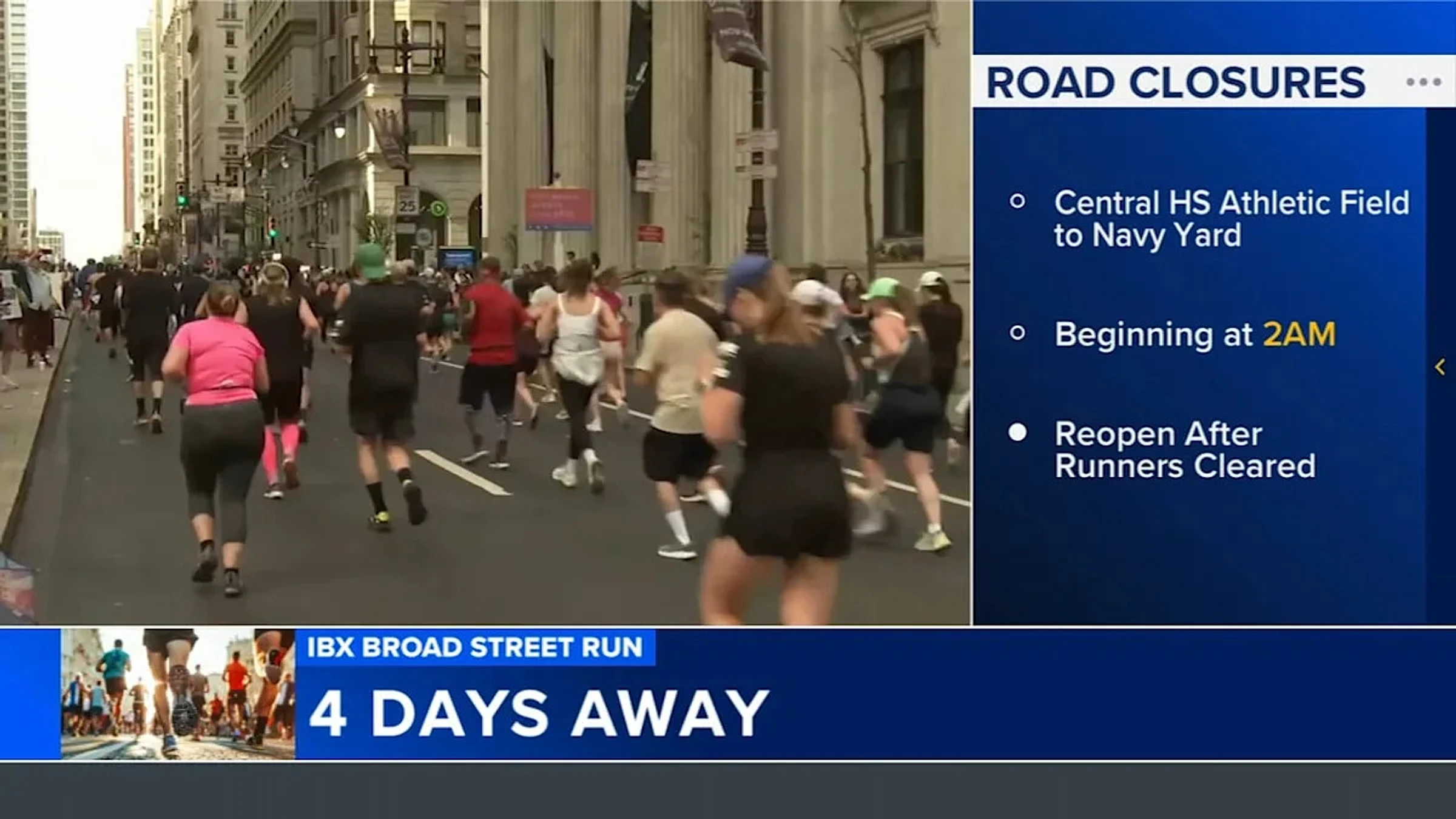
The course goes from the Central High School Athletic Field in Philadelphia's Logan section to the Navy Yard.
Track runners along the course and get notifications by registering on the Broad Street Run website. No app is required.
Phased road closures for the race will begin at 2 a.m. on Sunday.
No parking will be permitted on Broad Street, from Olney Avenue to the Navy Yard, between 2 a.m. and noon on Sunday.
WATCH: 6abc staffers among those preparing for Broad Street Run
If you're getting ready for the Independence Blue Cross Broad Street Run, you have plenty of company from those of us at 6abc.
The roads will reopen once all the runners are cleared. City officials said, based on previous years, the course is expected to reopen by noon.
A race guide is available on the Broad Street Run website.
Motorists are advised to use alternate routes, avoid areas along the racecourse, as well as allow for extra driving time and proceed with caution during the race.
The Philadelphia Police Department will be assigned to detours along the run route to assist motorists and help ensure safety for the runners.
There will also be an I-95 South detour since the Walt Whitman Bridge/Packer Avenue exit is closed for construction.
During the race, all Independence Blue Cross Broad Street Run traffic should exit at the Columbus Boulevard/Washington Avenue exit. Then, turn right on Columbus Boulevard and follow it all the way until it turns into Pattison Avenue.
Officials say taking public transportation will be the best way to get to the course.
If you're within the city, you can take the B (Broad Street Line). Runners can ride for free with their race bib.
You'll want to board at any station and ride north to Olney Transportation Center to get to the starting line. Trains are expected to run frequently, but expect crowds, officials say.
If you're walking, organizers say to follow signs for Center High School Athletic Field. Make sure you allow extra time for security and corrals.
For those traveling from the suburbs, you'll want to take the Regional Rail to Suburban Station, then transfer to the B Line at City Hall, riding north to Olney Transportation Center.
PATCO is the best option for those coming from New Jersey. Ride the PATCO to 12th/13th & Locust Streets. Then, walk two blocks west to Broad & Locust Streets, where you can enter the B Line and ride north to Olney Transportation Center.